4. Long Clove to Mt. Ivy
Section 4: Long Clove to Mt. Ivy
Quick Facts
Distance: 6.85 miles
Parks: High Tor State Park, South Mountain County Park, Gurnee County Park
Maps: Interactive Map, Hudson Palisades Trails (maps 111 and 112)
Print-Friendly Version: Link
General Description
In this section, the Long Path follows little-used roads for a mile, passes dramatic quarried cliffs of the Palisades, and then enters the woods and ascends High Tor. The ascent is often steep, with several good viewpoints. The open summit affords a 360-degree view up and down the Hudson Valley. The trail then descends from High Tor, ultimately passing Little Tor while following the ridge. After crossing Central Highway, the trail enters Rockland County's South Mountain Park. The section ends by descending off the western curving edge of the Palisades just before that feature plunges below the ground.
Access
This section begins on US Route 9W about 100 yards east of its junction with NY Route 304. The trail crosses Route 9W in the center of an "S" curve on the highway.
By public transportation: The Coach USA 11A bus stops at the intersection of Ridge Road and Old Route 304 (Rockland County Route 90, and erroneously shown as South Mountain Road on some maps), which the trail crosses.
Parking
0.00 Limited parking on the southeast side of Route 9W, across from Landmark Drive, formerly known as Long Clove Road. (41.17449°, -73.94458°)
1.15 Grassy area at the SW corner of Old Route 304 and Ridge Road, large enough for at least 4-5 cars. (41.17682°, -73.96148°)
4.75 Central Highway (limited parking). (41.19210°, -74.00450°)
6.85 Parking in Gurnee Park and Amphitheater on the east side of NY Route 45 in Mt. Ivy, 0.15 mile south of US Route 202. (41.18434°, -74.03635°)
On holidays and weekends, there is additional parking in the commuter parking lot at the corner of Routes 45 and 202.
Trail Description
0.00 The section begins by crossing US Route 9W and a guard rail, near a large Tilcon sign. The trail proceeds northward on Landmark Drive, an abandoned town road formerly known as Long Clove Road, and follows the road uphill around a sharp left hook.
0.60 Make a right turn onto Scratchup Road. The trail passes the gates for the Tilcon New York quarry.
1.00 The trail swings left and uphill to reach Old Route 304. Turn left here onto the road. This is a twisting road with narrow shoulders. Remember to walk single file facing traffic.
1.15 Pass Ridge Road on the left.
1.20 The trail turns right into the woods and crosses a wet area. It continues uphill, meandering beside and sometimes over stone walls.
1.70 The trail levels off and passes by a stand of mountain laurel. After a brief descent, the trail resumes uphill climbing to reach the ridge top near another stone wall. Halfway along the descent is a white-marked trail to the left and a sign saying: "Spur Path (High Tor State Park) - 2/10 mile to the site of the historic Youmans-Van Orden House and High Tor Vineyards."

View of Haverstraw from High Tor. 2001 [MICHAEL WARREN]
2.30 Reach the summit of High Tor. High Tor is the highest peak on the Palisades and its open, rocky summit affords spectacular views in all directions. The Hudson River vanishes to the north behind Dunderberg Mountain. Directly below, along the Hudson, is the Town of Haverstraw. The decommissioned Indian Point nuclear plant is visible across from Tomkins Cove. To the west, the rolling hills of the Ramapos and Harriman State Park may be seen. The polygonal pattern visible on the summit's rocks is a natural result of the cooling of the diabase that forms the Palisades. Colonists used the summit as a signal point during the Revolution, and it later was the site of an airplane beacon; the remains of the tower are still visible. The peak was the subject of Maxwell Anderson's play High Tor. The Long Path leaves High Tor and drops steeply into the woods.
2.45 The trail reaches the end of a fire road that it will follow gently downhill all the way to Central Highway. On the way, it runs through deciduous woods on or near the top of the ridge of the Palisades. The slope is steep to the right of the trail and gentle to the left.
3.05 The Long Path meets an unmarked trail to the right. This trail leads to a summit over the cliff edge.
3.70 The trail crosses a dirt road. To the right the road is blazed white, and heads briefly uphill and swings to the front of the open summit of Little Tor. To the left is a small artificial pond. It was the water source for the Kaatz mansion, a building demolished in the early 1970's during the construction of High Tor State Park. There is a fine view to the north, with Haverstraw directly below. As the Long Path continues to gradually descend along the ridge, it is crossed by many unmarked side trails and dirt roads.
4.45 Cross beneath a power line.
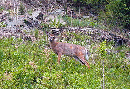
Deer by the trailside. 2001 [TODD SCHREIBMAN]
4.75 Cross Central Highway and enter Rockland County's South Mountain Park. The trail enters the woods on a gravel road, but just after passing the car barrier, it leaves the road and turns right onto a steep path. The trail is generally close to and parallel with the gravel road and crosses it once.
5.20 Join the gravel road briefly as it curves left. Follow the road for about 50 feet and than leave it to descend gently to the right. The Long Path is now a wide, well-cleared path through the woods following the cliff edge of the Palisades. There are extensive views to the south.
6.55 A precipice affords a view of Cheesecote Mountain and Limekiln, Catamount and Horse Stable Mountains. An old quarry and the edge of the Palisades can be seen looking down along the direction of the trail.
6.65 A view over an old quarry shows the end of the Palisades. Beyond, the Palisades ridge dips into the ground. The trail follows this last curving ridge downhill.
6.85 Reach the parking area in Gurnee Park and Amphitheater, a county park on the east side of NY Route 45.