Taconic State Park


Park Overview:
The trail system of the Southern Taconics features two parallel trails running north-south: the 21.4-mile South Taconic Trail following the western range and escarpment, and a 16.5-mile section of the Appalachian Trail on the eastern range.
Park Description:
Taconic State Park
East of the Harlem Valley of New York and west of the Housatonic Valley of Connecticut and Massachusetts rise the Taconics where Taconic State Park is located. The Taconics extend north through western Massachusetts and eastern New York into southwestern Vermont, where they reach their highest elevations. The name "Taconic" is a modern rendering of a Native American name variously spelled Taghkannock and Taghkanic.
- Seemingly remote from civilization, much of the highland in the south is protected as a relatively wild area. The trail system features sweeping views over the adjacent valleys to Mount Greylock to the north, the Catskill Mountains to the west, and the Hudson Highlands to the southwest.
A large part of the New York section of the highland lies along the western range and slope, sharing a border with Massachusetts and Connecticut. Near the northern end is the Taconic State Park Recreation Area. The park has outdoor recreation and camping facilities at its Copake Falls area south of Hillsdale and at its Rudd Pond area north of Millerton, both at the base of the highland.
The best-known natural site in the area is Bashbish Gorge, east of Taconic State Park in Massachusetts, with its towering walls and cascading brook ending in Bashbish Falls. Adjacent to the falls, also in Massachusetts, is Mount Washington State Forest (click for link to trail map) extending further south and traversed by the South Taconic Trail.
The Connecticut part of the highland is loosely called Mount Riga. Most of this section is owned by Mount Riga, Inc., a private conservation-minded body, but the National Park Service has acquired 1,225 acres from this group as a protective corridor for the Appalachian Trail. In 2008 The Nature Conservancy acquired an additional 621 acres from Mount Riga, Inc., along the New York State side of the Berkshire Taconic Ridge.
Trails Overview:
The trail system of the Southern Taconics features two parallel trails running north-south: the 21.4-mile South Taconic Trail following the western range and escarpment, and a 16.5-mile section of the Appalachian Trail on the eastern range. Other hiking routes consist mostly of side trails ascending to the highland from the valleys on either side. This system provides for circuit hikes, some of which include stretches of unpaved road. Use the Web Map link on this site to view trail maps prepared by NYSparks.
- The highly scenic South Taconic Trail lies mostly in Taconic State Park and Mount Washington State Forest along the western escarpment and range of the southern Taconics. The trail may be divided into two sections that together span 21.4 miles.
- South Taconic Trail, Southern Section [15.2 miles; white] goes from Rudd Pond Farms to NY 344, and includes steep, very rough sections.
- From the lower lot parking area on Route 344, it is worth hiking the Iron Works Trail [0.4 mile, green] to the Iron Works Museum and observe a beautifully restored furnace with related historical information and photographs.
- South Taconic Trail, Northern Section [6.2 miles; white] goes from NY 344 to NY 23.
- South Taconic Trail, Southern Section [15.2 miles; white] goes from Rudd Pond Farms to NY 344, and includes steep, very rough sections.
- The route of the Appalachian Trail through the southern Taconics lies entirely within Connecticut and Massachusetts. For a description see Appalachian Trail Guide to Massachusetts-Connecticut. The NY/NJ Trail Conference map South Taconic Trails shows this section of the AT and its feeder trails from Lions Head in Connecticut to Battlesite Monument in Massachusetts.
- A 4.0-mile segment of the Harlem Valley Rail Trail extends south from the Copake Falls area and a 1.2-mile segment extends north.
Click to find detailed descriptions of hikes in the park.
Park Acreage:
7000.00 acresMunicipality:
Copake FallsThe trail system of the Southern Taconics features two parallel trails running north-south: the 21.4-mile South Taconic Trail following the western range and escarpment, and a 16.5-mile section of the Appalachian Trail on the eastern range.
Taconic State Park
East of the Harlem Valley of New York and west of the Housatonic Valley of Connecticut and Massachusetts rise the Taconics where Taconic State Park is located. The Taconics extend north through western Massachusetts and eastern New York into southwestern Vermont, where they reach their highest elevations. The name "Taconic" is a modern rendering of a Native...
Park Acreage:
7000.00 acresMunicipality:
Copake FallsContact Information
Web Link:
Taconic State Park -- Copake Falls AreaPhone:
(518) 329-3993Fees:
Some times and places; check with parkDogs in park:
Dogs on leash
Hike Checklist:
Whether you are going for a day hike or backpacking overnight, it is good practice to carry what we call The Hiking Essentials. These essentials will help you enjoy your outing more and will provide basic safety gear if needed. There may also be more essentials, depending on the season and your needs.
The Essentials
Hiking Shoes or Boots
Water - Two quarts per person is recommended in every season. Keep in mind that fluid loss is heightened in winter as well as summer. Don't put yourself in the position of having to end your hike early because you have run out of water.
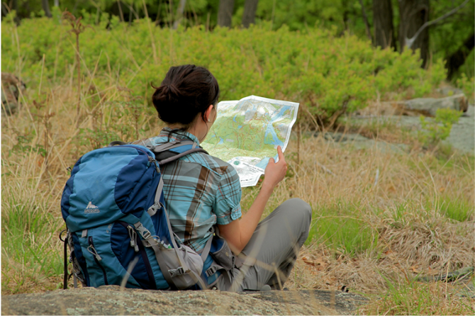
Map - Know where you are and where you are going. Many of our hiking areas feature interconnecting network of trails. Use a waterproof/tear-resistant Tyvek Trail Conference map if available or enclose your map in a Ziplock plastic bag. If you have a mobile device, download Avenza’s free PDF Maps app and grab some GPS-enhanced Trail Conference maps (a backup Tyvek or paper version of the map is good to have just in case your batteries die or you don't have service). Check out some map-reading basics here.
Food - Snacks/lunch will keep you going as you burn energy walking or climbing. Nuts, seeds, and chocolate are favorites on the trail.
Sunscreen and insect repellent
Rain Gear and Extra Clothing - Rain happens. So does cold. Be prepared for changing weather. Avoid cotton--it traps water against your skin and is slow to dry. If you are wearing wet cotton and must return to your starting point, you risk getting chills that may lead to a dangerous hypothermia. Choose synthetic shirts, sweaters and/or vests and dress in layers for easy on and off.
Compass - A simple compass is all you need to orient you and your map to magnetic north.
Light - A flashlight or small, lightweight headlamp will be welcome gear if you find yourself still on the trail when darkness falls. Check the batteries before you start out and have extras in your pack.
First Aid Kit - Keep it simple, compact, and weatherproof. Know how to use the basic components.
Firestarter and Matches - In an emergency, you may need to keep yourself or someone else warm until help arrives. A firestarter (this could be as simple as leftover birthday candles that are kept inside a waterproof container) and matches (again, make sure to keep them in a waterproof container) could save a life.
Knife or Multi-tool - You may need to cut a piece of moleskin to put over a blister, repair a piece of broken equipment, or solve some other unexpected problem.
Emergency Numbers - Know the emergency numbers for the area you're going to and realize that in many locations--especially mountainous ones, your phone will not get reception.
Common Sense - Pay attention to your environment, your energy, and the condition of your companions. Has the weather turned rainy? Is daylight fading? Did you drink all your water? Did your companion fail to bring rain gear? Are you getting tired? Keep in mind that until you turn around you are (typically) only half-way to completing your hike--you must still get back to where you started from! (Exceptions are loop hikes.)
Check the weather forecast before you head out. Know the rules and regulations of the area.
The Leave No Trace Seven Principles
Plan Ahead and Prepare
- Know the regulations and special concerns for the area you'll visit.
- Prepare for extreme weather, hazards, and emergencies.
- Schedule your trip to avoid times of high use.
- Visit in small groups when possible. Consider splitting larger groups into smaller groups.
- Repackage food to minimize waste.
- Use a map and compass to eliminate the use of marking paint, rock cairns or flagging.
Travel and Camp on Durable Surfaces
- Durable surfaces include established trails and campsites, rock, gravel, dry grasses or snow.
- Protect riparian areas by camping at least 200 feet from lakes and streams.
- Good campsites are found, not made. Altering a site is not necessary.
- In popular areas:
- Concentrate use on existing trails and campsites.
- Walk single file in the middle of the trail, even when wet or muddy.
- Keep campsites small. Focus activity in areas where vegetation is absent.
- In pristine areas:
- Disperse use to prevent the creation of campsites and trails.
- Avoid places where impacts are just beginning.
- Pack it in, pack it out. Inspect your campsite and rest areas for trash or spilled foods. Pack out all trash, leftover food and litter.
- Deposit solid human waste in catholes dug 6 to 8 inches deep, at least 200 feet from water, camp and trails. Cover and disguise the cathole when finished.
- Pack out toilet paper and hygiene products.
- To wash yourself or your dishes, carry water 200 feet away from streams or lakes and use small amounts of biodegradable soap. Scatter strained dishwater.
- Preserve the past: examine, but do not touch cultural or historic structures and artifacts.
- Leave rocks, plants and other natural objects as you find them.
- Avoid introducing or transporting non-native species.
- Do not build structures, furniture, or dig trenches.
- Campfires can cause lasting impacts to the backcountry. Use a lightweight stove for cooking and enjoy a candle lantern for light.
- Where fires are permitted, use established fire rings, fire pans, or mound fires.
- Keep fires small. Only use sticks from the ground that can be broken by hand.
- Burn all wood and coals to ash, put out campfires completely, then scatter cool ashes.
- Observe wildlife from a distance. Do not follow or approach them.
- Never feed animals. Feeding wildlife damages their health, alters natural behaviors, and exposes them to predators and other dangers.
- Protect wildlife and your food by storing rations and trash securely.
- Control pets at all times, or leave them at home.
- Avoid wildlife during sensitive times: mating, nesting, raising young, or winter.
Be Considerate of Other Visitors
- Respect other visitors and protect the quality of their experience.
- Be courteous. Yield to other users on the trail.
- Step to the downhill side of the trail when encountering pack stock.
- Take breaks and camp away from trails and other visitors.
- Let nature's sounds prevail. Avoid loud voices and noises.
The Trail Conference is a 2015 Leave No Trace partner.
(c) Leave No Trace Center for Outdoor Ethics: www.LNT.org.
Directions to Trailhead :
To reach Taconic State Park, take Taconic Parkway, exit at Claverack-Hillsdale Exit. Take Route 23 east for 8 miles into Hillsdale. Turn right onto Route 22 south and go 4 miles to Copake Falls. Turn left onto Route 344 east. Park entrance will be ½ mile on the left. GPS Coodinates: 42.121129, -73.519501
TRAIN TRANSPORT :
Not availableBUS TRANSPORT :
Not availableShare Your Experience
 Support the trails with a donation!