From the parking lot, head east (left when facing the woods), passing the Visitor Center to the left. You are following the red-on-white-blazed Pine Meadow Trail, which parallels Stony Brook, to the left. Continue ahead along this wide trail for 0.4 mile until you reach a fork. The yellow-blazed Stony Brook Trail, which proceeds straight ahead, will be your return route, but you should bear...
Hike Description:
From the parking lot, head east (left when facing the woods), passing the Visitor Center to the left. You are following the red-on-white-blazed Pine Meadow Trail, which parallels Stony Brook, to the left. Continue ahead along this wide trail for 0.4 mile until you reach a fork. The yellow-blazed Stony Brook Trail, which proceeds straight ahead, will be your return route, but you should bear right and continue along the red-on-white-blazed Pine Meadow Trail.
The trail dips slightly to cross Quartz Brook. There is a footbridge over the stream on the right, but when the water is low, the stream can easily be crossed on rocks. After crossing a gas pipeline right-of-way, the trail continues to follow a wide path along the hillside, high above Stony Brook (which can be heard below to the left).
About 1.2 miles from the start, the orange-blazed Hillburn-Torne-Sebago Trail joins briefly. Continue ahead on the red-on-white blazed Pine Meadow Trail. Soon, the blue-on-white-blazed Seven Hills Trail joins from the right. In another 500 feet, you’ll reach a junction. Here, the Pine Meadow and Seven Hills Trails turn left to cross Pine Meadow Brook on a footbridge, but you should continue ahead (don’t cross the footbridge), now following the white-blazed Kakiat Trail.
The Kakiat Trail climbs gradually for about a third of a mile until it reaches the start of the black-on-white-blazed Raccoon Brook Hills Trail. You’ll be following this trail in a short while, but for now, continue ahead on the white-blazed Kakiat Trail. The trail levels off and passes some huge boulders to the right. It then turns left to cross an intermittent stream and continues through a dense mountain laurel thicket, with an understory of blueberry bushes.
After climbing a narrow passage through rocks and passing jumbled boulders to the right, the Kakiat Trail is joined by the black-on-white-blazed Raccoon Brook Hills Trail. The two trails run together for about 100 feet, and when they diverge, turn left and follow the Raccoon Brook Hills Trail. The trail descends gradually for a short distance, then climbs steeply to an open rock ledge, with pitch pines and scrub oak. There is a view to the southwest from here, and it might seem like the summit – but it’s not. Just ahead, you’ll encounter another steep, rocky climb, with a wooden ladder placed at a particularly steep spot near the top.
At the top of the climb (elevation 1,150 feet), the trail comes out on a rock ledge with a panoramic southwest-facing view. This spot – the western summit of the mountain – is the halfway point of the hike, and it’s a good place to take a break. The trail continues along the crest of the ridge, soon once again coming out on open rocks, with more views. It then descends through thick mountain laurel, comes out on an open area, and climbs slightly to reach the eastern summit. Pine Meadow Lake is to the right, but the lake cannot be seen from the summit when there are leaves on the trees.
The Raccoon Brook Hills Trail now begins a steep descent. At the base of the descent, a junction is reached with the yellow-on-white-blazed Poached Egg Trail. Here, the Raccoon Brook Hills Trail turns left, but you should continue ahead on the Poached Egg Trail. This short trail proceeds through a rocky area to reach Pine Meadow Road West – an unmarked dirt road, built in the 1930s by the Civilian Conservation Corps (CCC).
Turn left onto Pine Meadow Road West, which runs near the shore of Pine Meadow Lake. In about a third of a mile, the road comes out on the lake shore. You’ll want to stop here and enjoy the beauty of this scenic lake. Built by the CCC in 1934, it was designed to serve children’s camps that would be developed around the lake, but these camps were never established.
Continue ahead and cross the dam of the lake (which was designed to accommodate a two-lane road). About 100 feet beyond the dam, turn left onto the red-on-white-blazed Pine Meadow Trail, which descends on a woods road. At the base of the descent, after crossing a wide, shallow stream, the Pine Meadow Trail curves to the right and reaches, in about 200 feet, a junction with the yellow-blazed Diamond Mountain-Tower Trail.
Turn left on the yellow trail, which almost immediately turns right and climbs Diamond Mountain on switchbacks. As you reach the top, there is an excellent view back over Pine Meadow Lake. At the crest of the ridge, the Diamond Mountain-Tower Trail ends at a junction with the blue-on-white-blazed Seven Hills Trail and the orange-blazed Hillburn-Torne-Sebago Trail. Turn left and follow the blue and orange trails, which soon reach a panoramic viewpoint to the west and north.
A short distance beyond, where the trails separate, bear right and follow the orange-blazed Hillburn-Torne-Sebago Trail. The trail descends very steeply for a short distance, then levels off and follows the ridge of Halfway Mountain for about half a mile. At a west-facing viewpoint, the trail begins a gradual descent to Pine Meadow Brook.
At the brook, the Hillburn-Torne-Sebago Trail reaches a junction with the white-blazed Kakiat Trail. Turn right and follow the Kakiat Trail, which proceeds over and around huge boulders. In another quarter of a mile, you’ll reach a junction with the yellow-blazed Stony Brook Trail. Turn left, now following both white and yellow blazes, and cross a footbridge over Pine Meadow Brook. (Note: As of August 2019, this bridge is out. If the water in the brook is low, it is possible to cross the brook on rocks. If this is not possible, you can backtrack on the Kakiat Trail for a quarter mile and cross the brook on the HTS bridge at the Cascade of Slid, then turn right and return to the trailhead on the Pine Meadow Trail.) A short distance beyond, the Kakiat Trail leaves to the right, but you should continue ahead on the yellow-blazed Stony Brook Trail. This section of the trail, which closely parallels the cascading brook, is particularly scenic.
After crossing a gas pipeline right-of-way and then a wooden bridge over Quartz Brook, the Stony Brook Trail ends at a junction with the red-on-white-blazed Pine Meadow Trail. Continue ahead on the Pine Meadow Trail, which parallels Stony Brook and leads back to the parking lot where the hike began.
Publication: Submitted by Daniel Chazin on 10/07/2005

This loop hike at the southern end of the park climbs Raccoon Brook Hill and Diamond Mountain, with several panoramic viewpoints, and runs along cascading Stony Brook and scenic Pine Meadow Lake.
41.173916, -74.168658
Rockland Co., NY
7 mi
4.5 hrs

Buy Book: Circuit Hikes in Harriman
Avenza App Map: Harriman-Bear Mountain 118
Hike Checklist:
Whether you are going for a day hike or backpacking overnight, it is good practice to carry what we call The Hiking Essentials. These essentials will help you enjoy your outing more and will provide basic safety gear if needed. There may also be more essentials, depending on the season and your needs.
The Essentials
Hiking Shoes or Boots
Water - Two quarts per person is recommended in every season. Keep in mind that fluid loss is heightened in winter as well as summer. Don't put yourself in the position of having to end your hike early because you have run out of water.
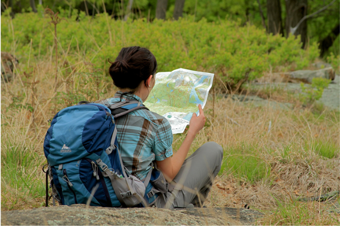
Map - Know where you are and where you are going. Many of our hiking areas feature interconnecting network of trails. Use a waterproof/tear-resistant Tyvek Trail Conference map if available or enclose your map in a Ziplock plastic bag. If you have a mobile device, download Avenza’s free PDF Maps app and grab some GPS-enhanced Trail Conference maps (a backup Tyvek or paper version of the map is good to have just in case your batteries die or you don't have service). Check out some map-reading basics here.
Food - Snacks/lunch will keep you going as you burn energy walking or climbing. Nuts, seeds, and chocolate are favorites on the trail.
Sunscreen and insect repellent
Rain Gear and Extra Clothing - Rain happens. So does cold. Be prepared for changing weather. Avoid cotton--it traps water against your skin and is slow to dry. If you are wearing wet cotton and must return to your starting point, you risk getting chills that may lead to a dangerous hypothermia. Choose synthetic shirts, sweaters and/or vests and dress in layers for easy on and off.
Compass - A simple compass is all you need to orient you and your map to magnetic north.
Light - A flashlight or small, lightweight headlamp will be welcome gear if you find yourself still on the trail when darkness falls. Check the batteries before you start out and have extras in your pack.
First Aid Kit - Keep it simple, compact, and weatherproof. Know how to use the basic components.
Firestarter and Matches - In an emergency, you may need to keep yourself or someone else warm until help arrives. A firestarter (this could be as simple as leftover birthday candles that are kept inside a waterproof container) and matches (again, make sure to keep them in a waterproof container) could save a life.
Knife or Multi-tool - You may need to cut a piece of moleskin to put over a blister, repair a piece of broken equipment, or solve some other unexpected problem.
Emergency Numbers - Know the emergency numbers for the area you're going to and realize that in many locations--especially mountainous ones, your phone will not get reception.
Common Sense - Pay attention to your environment, your energy, and the condition of your companions. Has the weather turned rainy? Is daylight fading? Did you drink all your water? Did your companion fail to bring rain gear? Are you getting tired? Keep in mind that until you turn around you are (typically) only half-way to completing your hike--you must still get back to where you started from! (Exceptions are loop hikes.)
Check the weather forecast before you head out. Know the rules and regulations of the area.
The Leave No Trace Seven Principles
Plan Ahead and Prepare
- Know the regulations and special concerns for the area you'll visit.
- Prepare for extreme weather, hazards, and emergencies.
- Schedule your trip to avoid times of high use.
- Visit in small groups when possible. Consider splitting larger groups into smaller groups.
- Repackage food to minimize waste.
- Use a map and compass to eliminate the use of marking paint, rock cairns or flagging.
Travel and Camp on Durable Surfaces
- Durable surfaces include established trails and campsites, rock, gravel, dry grasses or snow.
- Protect riparian areas by camping at least 200 feet from lakes and streams.
- Good campsites are found, not made. Altering a site is not necessary.
- In popular areas:
- Concentrate use on existing trails and campsites.
- Walk single file in the middle of the trail, even when wet or muddy.
- Keep campsites small. Focus activity in areas where vegetation is absent.
- In pristine areas:
- Disperse use to prevent the creation of campsites and trails.
- Avoid places where impacts are just beginning.
- Pack it in, pack it out. Inspect your campsite and rest areas for trash or spilled foods. Pack out all trash, leftover food and litter.
- Deposit solid human waste in catholes dug 6 to 8 inches deep, at least 200 feet from water, camp and trails. Cover and disguise the cathole when finished.
- Pack out toilet paper and hygiene products.
- To wash yourself or your dishes, carry water 200 feet away from streams or lakes and use small amounts of biodegradable soap. Scatter strained dishwater.
- Preserve the past: examine, but do not touch cultural or historic structures and artifacts.
- Leave rocks, plants and other natural objects as you find them.
- Avoid introducing or transporting non-native species.
- Do not build structures, furniture, or dig trenches.
- Campfires can cause lasting impacts to the backcountry. Use a lightweight stove for cooking and enjoy a candle lantern for light.
- Where fires are permitted, use established fire rings, fire pans, or mound fires.
- Keep fires small. Only use sticks from the ground that can be broken by hand.
- Burn all wood and coals to ash, put out campfires completely, then scatter cool ashes.
- Observe wildlife from a distance. Do not follow or approach them.
- Never feed animals. Feeding wildlife damages their health, alters natural behaviors, and exposes them to predators and other dangers.
- Protect wildlife and your food by storing rations and trash securely.
- Control pets at all times, or leave them at home.
- Avoid wildlife during sensitive times: mating, nesting, raising young, or winter.
Be Considerate of Other Visitors
- Respect other visitors and protect the quality of their experience.
- Be courteous. Yield to other users on the trail.
- Step to the downhill side of the trail when encountering pack stock.
- Take breaks and camp away from trails and other visitors.
- Let nature's sounds prevail. Avoid loud voices and noises.
The Trail Conference is a 2015 Leave No Trace partner.
(c) Leave No Trace Center for Outdoor Ethics: www.LNT.org.
Directions to Trailhead :
Take N.J. Route 17 north to the New York State Thruway and take the first exit, Exit 15A (Sloatsburg). Turn left at the bottom of the ramp onto N.Y. Route 17 north, and continue through the Village of Sloatsburg. Just past the village, turn right at the traffic light, following the sign for Harriman State Park. Cross an overpass over railroad tracks and continue along the Seven Lakes Drive, passing under the Thruway overpass, and soon entering Harriman State Park. Proceed for another mile to the Reeves Meadow Visitor Center, on the right side of the road. Park in the Visitor Center's parking lot.
TRAIN TRANSPORT :
Take the NJ Transit/Metro-North Port Jervis Line to the Sloatsburg station. From the station, cross the railroad tracks and head north on Ballard Avenue. When Ballard Avenue ends, turn right onto Academy Avenue and continue to Seven Lakes Drive. Turn right on Seven Lakes Drive, continue under the New York State Thruway, and pass Greenway Road and Laurel Road on the right. A short distance beyond, about 0.9 mile from the train station, you'll reach a bridge over the Stony Brook. On the bridge, you will notice a triple red-square-on-white blaze and a directional arrow, which mark the trailhead of the Pine Meadow Trail. Turn right, leaving the road, and follow this red-on-white-blazed trail for another 0.8 mile to the Reeves Meadow Visitor Center.
BUS TRANSPORT :
Not availableShare Your Experience
SUPPORT
 Support the trails with a donation!
Trail Conference volunteers maintain trails in this hike.
Trip Reports
rate experience September 06, 2014
enjoyed it
<p>I went with my wife 9/3/14 - a weekday</p>
<p>We went kind of spur of the moment without looking at a map- just following the directions above<br>Our 2nd hike (first hike was evening before) </p>
<p>It was a nice hike - with 0 people encounted on RBH path and only 1 person seen at the lake and then 0 people again on Diamond Mountain. </p>
<p>However I think we made the same mistake as the earlier commenter - </p>
<p>At the peak of <span style="color: #111111; font-family: Verdana, Arial, Helvetica, sans-serif; line-height: 14.5920000076294px; background-color: #ffffff;">Diamond Mountain we stopped not to disturb some eagles and when we turned around behind us we saw the views of the lake we just visited. Going forward again we found the blue & orange trail markers together on the same path but they continued on to the Right - not the Left as described in the instuctions above. We doubled back to look for any orange trail markers going to the left but found none - we only found the blue trail going to the left but looking down the blue trail that went left we did not see any orange blazes. </span></p>
<p>If we had stopped to study the map we would have either fought through and found a hidden orange trail or at least have taken the blue trail. Instead we did not feel like stopping and just followed the orange and blue trail down to the Right and it did steeply descend as described in the instructions and it did eventually meet up with a brook as described but it also took us a bit out of the way. At the Brook with no white blazes anywhere to be found we saw the beginning of the yellow trail so we took this (long) trail along the brook and got back on track. </p>
<p>All in all it took us 5 hours - this includes stopping for a 20 min lunch, stopping to look at lake, backtracking, searching for white trail, and stopping to enjoy views - however we walked quickly the whole way. </p>
<p>Next hike I am plotting it out on the map beforehand so I don't make it longer than it is</p>
<p>I had only brought a soda can with me and I drank it at RBH summit so staring at the cool water brook on the long way home I was getting thirsty lol - </p>
<p>We will be back for sure when we have time to try another one - thanks!</p>
<p> </p>
<p> </p>
September 29, 2012
Nice scenery
<p>The trail was not bad, the scenery was beautiful, but the trail has a good amount of broken glass, garbage, and is absolutely flooded with people. I enjoy meeting people on the trail, but there were groups of 5-10 at every single resting spot. We were not able to walk for more than 5 minutes before running into another group.</p>
<p>I do think there was some type of -- convention or meeting when we went. Most of them were very inexperienced, were constantly screaming back down the trail at each other, and talking extremely loud. I enjoy hiking because of the peace and quiet and you will definitely not find it on this trail.</p>
September 03, 2012
really good time
<p> I just did this hike this weekend and it was a blast. very challenging but well worth it. must be in shape to do. directions were great, got a little confused at the bottom of the second steep descent, got to an intersection of orange and yellow. thankfully we picked yellow and folled back to red and white with the stony brook to our right. thankfully we ended up back in the parking lot just at dark. everyone was friendly as can be too. took 5.5 hours but we took long breaks and really enjoyed the entire day.</p>