From the kiosk near the entrance to the parking lot, follow a gravel path across an open area that heads northeast, parallel to University Drive. At the edge of the woods, you will notice a brown post, which marks the start of the red-blazed Woodland Trail. Follow the trail into the woods. The trail soon reaches a junction where it bears right, passing a huge boulder on the left. Just beyond,...
Hike Description:
From the kiosk near the entrance to the parking lot, follow a gravel path across an open area that heads northeast, parallel to University Drive. At the edge of the woods, you will notice a brown post, which marks the start of the red-blazed Woodland Trail. Follow the trail into the woods. The trail soon reaches a junction where it bears right, passing a huge boulder on the left. Just beyond, the Woodland Trail reaches a T-intersection, where it turns left onto another woods road.
In another half mile, you’ll reach a high point on the trail, where a bench has been placed. Here, a sign and a triple-yellow blaze on a tree mark the start of the yellow-blazed Summit Trail (this point is also marked by a green sign as Location 2). Turn right onto the Summit Trail, which descends to a T-intersection, where you turn right. After crossing a small stream on rocks, the trail turns left at a sign for Location 3. It now begins to head north, passing just west of the low ridge known as Mt. Cecchino.
At a sign for Location 4, the trail bears right at a fork. Then, after following the Summit Trail for about two-thirds of a mile, the trail curves sharply to the left, crosses a small stream, and begins a steady climb to the summit of High Mountain along a rocky woods road. Near the top, the trail bears left onto a footpath, bypassing an eroded section of the road.
Just below the summit, the footpath rejoins the woods road at the Star of Hope (maintained by the Borough of North Haledon). Here, on the right, there is a panoramic east-facing viewpoint. On the horizon, beyond the suburban sprawl of northeastern New Jersey, you can see the New York City skyline. Through the trees on the right, you may be able to see the Verrazano-Narrows Bridge and even a corner of the Atlantic Ocean. Continue up to the summit, which resembles a grassy southern bald, with a few large exposures of basaltic bedrock.
When you’re ready to continue, head northwest across the broad summit, following the yellow blazes on rocks, and continue downhill on the Summit Trail. Be sure to follow the yellow blazes, as several paths and woods roads lead down the mountain. The Summit Trail crosses a secondary summit, levels off, then bears left at a fork at a sign for Location 6 and descends steeply on an eroded woods road.
Near the base of the descent, be alert for a sharp left turn (Location 7) where the yellow blazes turn left, leaving the woods road, and continue on a footpath. The Summit Trail now descends to a stream, bears left to parallel it, then bears right and crosses the stream on rocks. About 250 feet beyond the stream crossing, you’ll reach a woods road (with a sign providing trail mileages, as well as a green sign marking Location 8).
Turn left onto the road, the route of the red-blazed Woodland Trail, and head south. You’ll pass through an area which is often wet, but the trail route soon becomes drier. Further down the road, the trail passes several clusters of cedar trees, and it descends over slabs of exposed basalt.
After about a mile on the Woodland Trail, the white-blazed Brookside Trail begins on the right at a sign. You should continue ahead on the red-blaze Woodland Trail. Then, in another 400 feet, you’ll reach the junction with the Summit Trail that you encountered earlier in the hike. Continue ahead on the Woodland Trail (now retracing your steps) and follow it back to the parking lot where the hike began.
To view a photo collection for this hike, click here.
Publication: Submitted by Daniel Chazin on 04/22/2010 updated/verified on 02/25/2024

This loop hike climbs to the summit of the highest mountain in view of the ocean on the east coast (south of Maine), with outstanding views.
40.951987, -74.200308
Passaic Co., NJ
4 mi
2.5 hrs

Buy Map: Morris County Highlands Trails Map
Avenza App Map: Morris County Highlands 128
Hike Checklist:
Whether you are going for a day hike or backpacking overnight, it is good practice to carry what we call The Hiking Essentials. These essentials will help you enjoy your outing more and will provide basic safety gear if needed. There may also be more essentials, depending on the season and your needs.
The Essentials
Hiking Shoes or Boots
Water - Two quarts per person is recommended in every season. Keep in mind that fluid loss is heightened in winter as well as summer. Don't put yourself in the position of having to end your hike early because you have run out of water.
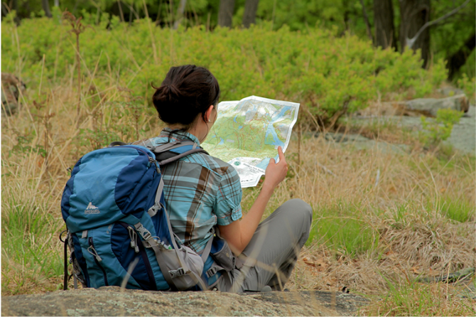
Map - Know where you are and where you are going. Many of our hiking areas feature interconnecting network of trails. Use a waterproof/tear-resistant Tyvek Trail Conference map if available or enclose your map in a Ziplock plastic bag. If you have a mobile device, download Avenza’s free PDF Maps app and grab some GPS-enhanced Trail Conference maps (a backup Tyvek or paper version of the map is good to have just in case your batteries die or you don't have service). Check out some map-reading basics here.
Food - Snacks/lunch will keep you going as you burn energy walking or climbing. Nuts, seeds, and chocolate are favorites on the trail.
Sunscreen and insect repellent
Rain Gear and Extra Clothing - Rain happens. So does cold. Be prepared for changing weather. Avoid cotton--it traps water against your skin and is slow to dry. If you are wearing wet cotton and must return to your starting point, you risk getting chills that may lead to a dangerous hypothermia. Choose synthetic shirts, sweaters and/or vests and dress in layers for easy on and off.
Compass - A simple compass is all you need to orient you and your map to magnetic north.
Light - A flashlight or small, lightweight headlamp will be welcome gear if you find yourself still on the trail when darkness falls. Check the batteries before you start out and have extras in your pack.
First Aid Kit - Keep it simple, compact, and weatherproof. Know how to use the basic components.
Firestarter and Matches - In an emergency, you may need to keep yourself or someone else warm until help arrives. A firestarter (this could be as simple as leftover birthday candles that are kept inside a waterproof container) and matches (again, make sure to keep them in a waterproof container) could save a life.
Knife or Multi-tool - You may need to cut a piece of moleskin to put over a blister, repair a piece of broken equipment, or solve some other unexpected problem.
Emergency Numbers - Know the emergency numbers for the area you're going to and realize that in many locations--especially mountainous ones, your phone will not get reception.
Common Sense - Pay attention to your environment, your energy, and the condition of your companions. Has the weather turned rainy? Is daylight fading? Did you drink all your water? Did your companion fail to bring rain gear? Are you getting tired? Keep in mind that until you turn around you are (typically) only half-way to completing your hike--you must still get back to where you started from! (Exceptions are loop hikes.)
Check the weather forecast before you head out. Know the rules and regulations of the area.
The Leave No Trace Seven Principles
Plan Ahead and Prepare
- Know the regulations and special concerns for the area you'll visit.
- Prepare for extreme weather, hazards, and emergencies.
- Schedule your trip to avoid times of high use.
- Visit in small groups when possible. Consider splitting larger groups into smaller groups.
- Repackage food to minimize waste.
- Use a map and compass to eliminate the use of marking paint, rock cairns or flagging.
Travel and Camp on Durable Surfaces
- Durable surfaces include established trails and campsites, rock, gravel, dry grasses or snow.
- Protect riparian areas by camping at least 200 feet from lakes and streams.
- Good campsites are found, not made. Altering a site is not necessary.
- In popular areas:
- Concentrate use on existing trails and campsites.
- Walk single file in the middle of the trail, even when wet or muddy.
- Keep campsites small. Focus activity in areas where vegetation is absent.
- In pristine areas:
- Disperse use to prevent the creation of campsites and trails.
- Avoid places where impacts are just beginning.
- Pack it in, pack it out. Inspect your campsite and rest areas for trash or spilled foods. Pack out all trash, leftover food and litter.
- Deposit solid human waste in catholes dug 6 to 8 inches deep, at least 200 feet from water, camp and trails. Cover and disguise the cathole when finished.
- Pack out toilet paper and hygiene products.
- To wash yourself or your dishes, carry water 200 feet away from streams or lakes and use small amounts of biodegradable soap. Scatter strained dishwater.
- Preserve the past: examine, but do not touch cultural or historic structures and artifacts.
- Leave rocks, plants and other natural objects as you find them.
- Avoid introducing or transporting non-native species.
- Do not build structures, furniture, or dig trenches.
- Campfires can cause lasting impacts to the backcountry. Use a lightweight stove for cooking and enjoy a candle lantern for light.
- Where fires are permitted, use established fire rings, fire pans, or mound fires.
- Keep fires small. Only use sticks from the ground that can be broken by hand.
- Burn all wood and coals to ash, put out campfires completely, then scatter cool ashes.
- Observe wildlife from a distance. Do not follow or approach them.
- Never feed animals. Feeding wildlife damages their health, alters natural behaviors, and exposes them to predators and other dangers.
- Protect wildlife and your food by storing rations and trash securely.
- Control pets at all times, or leave them at home.
- Avoid wildlife during sensitive times: mating, nesting, raising young, or winter.
Be Considerate of Other Visitors
- Respect other visitors and protect the quality of their experience.
- Be courteous. Yield to other users on the trail.
- Step to the downhill side of the trail when encountering pack stock.
- Take breaks and camp away from trails and other visitors.
- Let nature's sounds prevail. Avoid loud voices and noises.
The Trail Conference is a 2015 Leave No Trace partner.
(c) Leave No Trace Center for Outdoor Ethics: www.LNT.org.
Directions to Trailhead :
Take Route 208 west to the second Goffle Road exit (towards Hawthorne/Paterson) and turn right at the end of the ramp. At the next light, just beyond the intersection with Goffle Hill Road, turn right onto North Watchung Drive. At a "stop" sign at the top of the hill, turn sharply right onto Rea Avenue, which becomes North Haledon Avenue and then Linda Vista Avenue. At a T-intersection with Terrace Avenue, turn right, then bear left to continue on Linda Vista Avenue. After crossing High Mountain Road, the name of the street changes to Overlook Avenue. Continue ahead into William Paterson University (Entry 6). At the next "stop" sign, turn right and continue for 0.4 mile to a small parking area on the right, with a sign "High Mountain Park."
TRAIN TRANSPORT :
Not availableBUS TRANSPORT :
Not availableShare Your Experience
SUPPORT
 Support the trails with a donation!
Trail Conference volunteers maintain trails in this hike.
Trip Reports
rate experience January 08, 2018
Yellow Trail at High Mountain has been reblazed orange
<p>The section of the Yellow Trail west of the White Trail is now blazed orange, and has been designated a separate trail from the Yellow Trail. Formerly, two yellow trails left from the Reservoir Drive circle, and this caused some user confusion. To prevent this confusion, the western section of what was formerly the Yellow Trail is now blazed orange. The Park has new trail maps reflecting this change </p>
January 07, 2018
Orange Yellow Trail?
While hiking around HMPP recently, I noticed that it seems the trail blazes for the portion of the yellow trail west of the white trail are more of an orange color than the yellow blazes east of the white trail. Is this intentional?
July 24, 2017
Overgrown?
I'm curious as to what parts of the yellow trail lp99 felt were overgrown and not marked well. In my estimation, beginning at the parking lot on University Drive, the red trail to the yellow trail to the summit of High Mountain is the most heavily traveled route in the whole preserve and is well marked.