From the vehicle turnaround at the eastern end of the parking area, follow the yellow-blazed West Trapps Connector Trail, a gravel road which leads east, parallel to Route 44/55. In 0.2 mile, you’ll reach the Trapps Bridge. Climb the gravel road that leads up to the bridge, turn sharply right, cross the bridge, then turn right again. About 150 feet beyond the bridge, a sign and a triple-blue...
Hike Description:
From the vehicle turnaround at the eastern end of the parking area, follow the yellow-blazed West Trapps Connector Trail, a gravel road which leads east, parallel to Route 44/55. In 0.2 mile, you’ll reach the Trapps Bridge. Climb the gravel road that leads up to the bridge, turn sharply right, cross the bridge, then turn right again. About 150 feet beyond the bridge, a sign and a triple-blue blaze mark the start of the Millbrook Ridge Trail. Turn left and follow this trail – marked with plastic markers on trees and paint blazes on rocks – which steeply climbs over rock slabs dotted with pitch pines.
At the top of the steep climb, you’ll reach the crest of the ridge (known as the Near Trapps). Here, there is a panoramic viewpoint, known as the Hawk Watch. To the left, you can see Dickie Barre, with the Catskill Mountains in the distance beyond. To the right, there is a sweeping view over the Wallkill Valley, with New Paltz visible in the distance. This is a good spot to rest and take a break from the climb.
The trail continues to climb through a wooded area along the ridge, with scrub oak and pitch pine and an understory of blueberry bushes. Soon, you’ll reach another viewpoint on the left, with the Sky Top tower of the Mohonk Mountain House visible to the north, and the intersection of Routes 299 and 44/55 directly below. The trail now levels off. After a brief climb up a rock outcrop, the trail begins to descend.
About a mile from the start, you’ll reach a junction with the red-blazed Bayard's Path, which leaves to the right. Continue ahead on the blue-blazed Millbrook Ridge Trail, which bears left and climbs to the top of the next ridge, known as the Bayards. The trail follows along the ridge, reaching a broad viewpoint over the Wallkill Valley. A long, relatively level section follows, with the trail cutting through groves of mountain laurel and blueberry bushes. At the end of the level section, the trail passes on left a rounded outcrop with a view ahead (through the trees) of the dramatic cliff of Millbrook Mountain – the destination of the hike.
After descending through mountain laurel and hemlock, the Millbrook Ridge Trail arrives at a junction with the red-blazed Millbrook Cross Trail. You’ve now gone about two miles from the start. Continue ahead on the blue-blazed trail, which bends left and climbs to regain the crest of the ridge. Soon, it crosses a rock outcrop with several small glacial erratics. It continues on a relatively level footpath through laurel and hemlocks and emerges onto an open area, with many glacial erratics.
After traversing a rocky path through hemlocks and pines, the trail arrives at the base of a cliff. It climbs rather steeply over rocks to the right of the cliff and continues on a footpath below the crest of the ridge. Soon, the trail bears left, climbs on a rocky footpath through a boulder field, and proceeds through an open area, with blueberries and pitch pines, to reach the crest of the ridge. This is the start of the most interesting and dramatic part of the hike
The trail bears righ t and continues to climb along exposed rock outcrops, with views to the south and east over the Wallkill Valley as far as the Hudson Highlands. Sky Top may be seen to the northeast, and the Catskills in the distance to the north. After climbing some more, the trail follows a narrow path to the right of a sloping rock slab. Next, the trail climbs steeply to the very edge of the cliff, with a sheer 300-foot drop. Using extreme caution, you can peer over the sharp cliff edge and see the vast boulder field below – probably the moraine of a small glacier that remained after the main ice sheet had melted away. This is another good place for a break.
The trail continues to climb along the cliff edge, passing some more viewpoints, then heads slightly inland. Finally – a little over three miles from the start – you’ll arrive at a junction with the red-blazed Millbrook Mountain Trail. This is your return route, but first, continue ahead on the blue-blazed trail for 100 feet to a sign for the Millbrook Mountain Path. Here, you should turn left and climb the rock slab to the edge of the cliff – the summit of Millbrook Mountain, which offers an even broader view than those you’ve seen until now. After taking in the view, return to the first trail junction and turn left onto the red-blazed Millbrook Mountain Trail.
In 0.2 mile, turn right onto the blue-blazed Coxing Trail, which descends steadily over rock slabs dotted with pitch pines, then bears left and continues to descend through blueberry bushes, mountain laurel, hemlock and white pine. After leveling off and crossing a stream and a wet area on puncheons, the Coxing Trail reaches a junction with the Millbrook Cross Path, which begins on the right. Continue ahead on the Coxing Trail, which widens to a woods road. This section of the trail is often quite wet, and you may have to detour off the woods road to find a drier route.
About two miles from Millbrook Mountain, the Coxing Trail ends at a junction with the dirt Trapps Road, a carriage road built by the proprietors of the Mohonk and Minnewaska Mountain Houses. Turn right and follow this level road for about a mile to the Trapps Bridge. Cross the bridge, turn very sharply left, and follow the connector trail back to the parking area where you began the hike.
Publication: Submitted by Daniel Chazin on 10/30/2003 updated/verified on 10/09/2023

This loop hike climbs to the summit of Millbrook Mountain along spectacular cliffs of Shawangunk Conglomerate, with expansive views over the surrounding countryside.
41.73611, -74.200249
Ulster Co., NY
7 mi
4.5 hrs

Buy Map: *New* Shawangunk Trails Map
Avenza App Map: Shawangunk 105
Hike Checklist:
Whether you are going for a day hike or backpacking overnight, it is good practice to carry what we call The Hiking Essentials. These essentials will help you enjoy your outing more and will provide basic safety gear if needed. There may also be more essentials, depending on the season and your needs.
The Essentials
Hiking Shoes or Boots
Water - Two quarts per person is recommended in every season. Keep in mind that fluid loss is heightened in winter as well as summer. Don't put yourself in the position of having to end your hike early because you have run out of water.
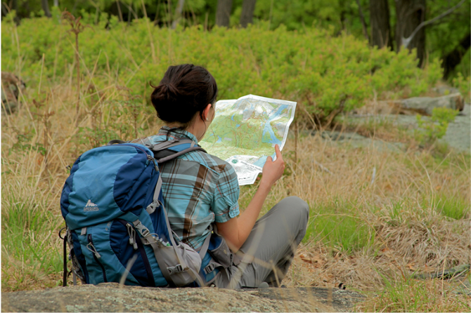
Map - Know where you are and where you are going. Many of our hiking areas feature interconnecting network of trails. Use a waterproof/tear-resistant Tyvek Trail Conference map if available or enclose your map in a Ziplock plastic bag. If you have a mobile device, download Avenza’s free PDF Maps app and grab some GPS-enhanced Trail Conference maps (a backup Tyvek or paper version of the map is good to have just in case your batteries die or you don't have service). Check out some map-reading basics here.
Food - Snacks/lunch will keep you going as you burn energy walking or climbing. Nuts, seeds, and chocolate are favorites on the trail.
Sunscreen and insect repellent
Rain Gear and Extra Clothing - Rain happens. So does cold. Be prepared for changing weather. Avoid cotton--it traps water against your skin and is slow to dry. If you are wearing wet cotton and must return to your starting point, you risk getting chills that may lead to a dangerous hypothermia. Choose synthetic shirts, sweaters and/or vests and dress in layers for easy on and off.
Compass - A simple compass is all you need to orient you and your map to magnetic north.
Light - A flashlight or small, lightweight headlamp will be welcome gear if you find yourself still on the trail when darkness falls. Check the batteries before you start out and have extras in your pack.
First Aid Kit - Keep it simple, compact, and weatherproof. Know how to use the basic components.
Firestarter and Matches - In an emergency, you may need to keep yourself or someone else warm until help arrives. A firestarter (this could be as simple as leftover birthday candles that are kept inside a waterproof container) and matches (again, make sure to keep them in a waterproof container) could save a life.
Knife or Multi-tool - You may need to cut a piece of moleskin to put over a blister, repair a piece of broken equipment, or solve some other unexpected problem.
Emergency Numbers - Know the emergency numbers for the area you're going to and realize that in many locations--especially mountainous ones, your phone will not get reception.
Common Sense - Pay attention to your environment, your energy, and the condition of your companions. Has the weather turned rainy? Is daylight fading? Did you drink all your water? Did your companion fail to bring rain gear? Are you getting tired? Keep in mind that until you turn around you are (typically) only half-way to completing your hike--you must still get back to where you started from! (Exceptions are loop hikes.)
Check the weather forecast before you head out. Know the rules and regulations of the area.
The Leave No Trace Seven Principles
Plan Ahead and Prepare
- Know the regulations and special concerns for the area you'll visit.
- Prepare for extreme weather, hazards, and emergencies.
- Schedule your trip to avoid times of high use.
- Visit in small groups when possible. Consider splitting larger groups into smaller groups.
- Repackage food to minimize waste.
- Use a map and compass to eliminate the use of marking paint, rock cairns or flagging.
Travel and Camp on Durable Surfaces
- Durable surfaces include established trails and campsites, rock, gravel, dry grasses or snow.
- Protect riparian areas by camping at least 200 feet from lakes and streams.
- Good campsites are found, not made. Altering a site is not necessary.
- In popular areas:
- Concentrate use on existing trails and campsites.
- Walk single file in the middle of the trail, even when wet or muddy.
- Keep campsites small. Focus activity in areas where vegetation is absent.
- In pristine areas:
- Disperse use to prevent the creation of campsites and trails.
- Avoid places where impacts are just beginning.
- Pack it in, pack it out. Inspect your campsite and rest areas for trash or spilled foods. Pack out all trash, leftover food and litter.
- Deposit solid human waste in catholes dug 6 to 8 inches deep, at least 200 feet from water, camp and trails. Cover and disguise the cathole when finished.
- Pack out toilet paper and hygiene products.
- To wash yourself or your dishes, carry water 200 feet away from streams or lakes and use small amounts of biodegradable soap. Scatter strained dishwater.
- Preserve the past: examine, but do not touch cultural or historic structures and artifacts.
- Leave rocks, plants and other natural objects as you find them.
- Avoid introducing or transporting non-native species.
- Do not build structures, furniture, or dig trenches.
- Campfires can cause lasting impacts to the backcountry. Use a lightweight stove for cooking and enjoy a candle lantern for light.
- Where fires are permitted, use established fire rings, fire pans, or mound fires.
- Keep fires small. Only use sticks from the ground that can be broken by hand.
- Burn all wood and coals to ash, put out campfires completely, then scatter cool ashes.
- Observe wildlife from a distance. Do not follow or approach them.
- Never feed animals. Feeding wildlife damages their health, alters natural behaviors, and exposes them to predators and other dangers.
- Protect wildlife and your food by storing rations and trash securely.
- Control pets at all times, or leave them at home.
- Avoid wildlife during sensitive times: mating, nesting, raising young, or winter.
Be Considerate of Other Visitors
- Respect other visitors and protect the quality of their experience.
- Be courteous. Yield to other users on the trail.
- Step to the downhill side of the trail when encountering pack stock.
- Take breaks and camp away from trails and other visitors.
- Let nature's sounds prevail. Avoid loud voices and noises.
The Trail Conference is a 2015 Leave No Trace partner.
(c) Leave No Trace Center for Outdoor Ethics: www.LNT.org.
Directions to Trailhead :
Take the New York State Thruway to Exit 18 (New Paltz). At the end of the exit ramp, turn left onto Route 299 and continue west through the Village of New Paltz. When you cross the bridge over the Wallkill River at the west end of the village, continue ahead on Route 299 (do not turn right towards the Mohonk Mountain House). In another 5.5 miles (from the Wallkill River bridge), Route 299 ends at a T intersection with Route 44/55. Turn right here and follow Route 44/55 for half a mile to the Mohonk Preserve Visitor Center, on the right side of the road. Stop at the visitor center to purchase a pass ($15 per person daily trail use fee; $70 annual pass), obtain a free map and view the interesting exhibits. Then continue ahead on Route 44/55. The road makes a very sharp hairpin turn and climbs to the Trapps Bridge. Continue for 0.3 mile past Trapps Bridge and turn right into the West Trapps Trailhead Parking Area.
TRAIN TRANSPORT :
Not availableBUS TRANSPORT :
Bus service to New Paltz from New York City, Nanuet, Newburgh and Kingston is available via Adirondack Trailways, www.trailwaysny.com (800) 776-7548. Limited weekday bus service to New Paltz from Kingston and Highland is available via Routes R and H of Ulster County Area Transit, www.co.ulster.ny.us/ucat (888) 827-8228. Ulster County Area Transit also offers bus service from the Metro-North station in Poughkeepsie to New Paltz via their Ulster-Poughkeepsie Link. Taxi service from New Paltz to Mohonk is available from New Paltz Taxi, www.npztaxi.com (845) 255-1550.
 Support the trails with a donation!
Trip Reports
rate experience
No reviews for this hike, click above rate experience link to review this hike
Log in or register to post comments