The Apshawa Preserve is a rugged 576-acre tract owned by Passaic County and the New Jersey Conservation Foundation. About seven miles of trails traverse the preserve, and this hike features the trails in the southern section of the preserve. The trails are marked with paint blazes and with colored plastic diamond blazes, some of which incorporate the logo of the New Jersey Conservation...
Hike Description:
The Apshawa Preserve is a rugged 576-acre tract owned by Passaic County and the New Jersey Conservation Foundation. About seven miles of trails traverse the preserve, and this hike features the trails in the southern section of the preserve. The trails are marked with paint blazes and with colored plastic diamond blazes, some of which incorporate the logo of the New Jersey Conservation Foundation.
At the northern end of the parking area, go through a gate in a deer fence and follow the Blue Trail, which first proceeds along a woods road, but continues on a footpath. After crossing a wet area on puncheons, the Blue Trail bears left and descends to cross a stream on a wooden footbridge. It then climbs a hill on a woods road, passing on the left the start of the Purple Trail. Continue ahead on the Blue Trail, which bears right at a high point and climbs some more, passing interesting rock formations on the left. Just beyond, the trail turns left, leaving the woods road, climbs over a rise and descends steeply into a ravine, where it turns left onto another woods road.
A short distance ahead, the White Trail begins on the right, but you should continue on the Blue Trail, which follows a relatively level woods road. After descending a little and looping around a vernal pond, you’ll pass the start of the Orange Trail on the left. This will be your return route, but for now, continue ahead on the Blue Trail.
 Soon, the trail crosses a broad expanse of open rock with several cedar trees and descends to Apshawa Brook, where the Blue Trail ends at a junction with the Green Trail. Turn right onto the Green Trail, which loops around, then turns left and crosses the brook on a metal bridge just before reaching a gate (do not go through the gate). Here, the Red Trail joins.
Continue to follow both green and red blazes as the trail climbs to a T-junction with a gravel road. Turn right onto the road, which leads in a short distance to a viewpoint over the Butler Reservoir, which has been officially renamed the Kathleen M. Caren Memorial Reservoir (due to safety concerns, the historic stone dam has been breached and a concrete spillway constructed to lower the water level of the reservoir). After taking in the view, return to the junction and continue ahead on the road.
After passing a small wetland on the right, follow the Green Trail as it turns left, leaving the road, and goes through a gate.  The Green Trail now begins a gradual but steady climb on a woods road, traversing an open deciduous forest with no understory. After passing through mountain laurel thickets and bearing left at a fork, the trail reaches the summit of a hill. Rock outcrops on the right afford views to the south and west, although the views are partially obscured by trees.
After pausing to take in the view, continue ahead on the Green Trail. You’ll pass interesting rock formations on the left and begin a steady descent on a winding footpath. Parts of the descent are rather steep.
At the base of the descent, the trail turns left onto a woods road which parallels Apshawa Brook. It heads uphill, passing beautiful cascades in the brook, below on the right. A short distance ahead, you'll come to a fork. Bear right, following the green blazes, and descend to the brook.
To your right, you'll notice four huge rusted tanks that were installed as part of a water purification system in the early 1900s. Here, the trail crosses the brook on rocks and turns left, passing the ruins of two small stone-and-concrete buildings. Follow the green blazes upstream along the brook on a rocky footpath. Soon, you'll come to the base of a curved concrete dam, also built in the early 1900s to regulate the flow of water in the brook. The trail bears right and climbs to the top of the dam, with a nice view over the small reservoir that has been impounded behind the dam.
The Green Trail climbs through mountain laurel and hemlock, then bears left at a gate in the deer fence (don’t go through the gate). The trail now descends a little, then levels off. After a short climb on a rocky path, the Green Trail bears left, but you should continue straight ahead, now following the Orange Trail. The Orange Trail continues to the top of a rise, levels off, then descends to end at a junction with the Blue Trail. Turn right onto the Blue Trail and retrace your steps back to the parking area where the hike began.
Publication: Submitted by Daniel Chazin on 02/29/2008 updated/verified on 06/29/2023

This hike follows woods roads and footpaths through the southern area of the preserve, climbing to a viewpoint and passing beautiful cascades and interesting historical remnants of a century-old water purification plant.
41.025208, -74.374223
Passaic Co., NJ
4 mi
3 hrs

Web Map: Apshawa Preserve
Buy Map: Morris County Highlands Trails Map
Avenza App Map: Morris County Highlands 125
Hike Checklist:
Whether you are going for a day hike or backpacking overnight, it is good practice to carry what we call The Hiking Essentials. These essentials will help you enjoy your outing more and will provide basic safety gear if needed. There may also be more essentials, depending on the season and your needs.
The Essentials
Hiking Shoes or Boots
Water - Two quarts per person is recommended in every season. Keep in mind that fluid loss is heightened in winter as well as summer. Don't put yourself in the position of having to end your hike early because you have run out of water.
Map - Know where you are and where you are going. Many of our hiking areas feature interconnecting network of trails. Use a waterproof/tear-resistant Tyvek Trail Conference map if available or enclose your map in a Ziplock plastic bag. If you have a mobile device, download Avenza’s free PDF Maps app and grab some GPS-enhanced Trail Conference maps (a backup Tyvek or paper version of the map is good to have just in case your batteries die or you don't have service). Check out some map-reading basics here.
Food - Snacks/lunch will keep you going as you burn energy walking or climbing. Nuts, seeds, and chocolate are favorites on the trail.
Sunscreen and insect repellent
Rain Gear and Extra Clothing - Rain happens. So does cold. Be prepared for changing weather. Avoid cotton--it traps water against your skin and is slow to dry. If you are wearing wet cotton and must return to your starting point, you risk getting chills that may lead to a dangerous hypothermia. Choose synthetic shirts, sweaters and/or vests and dress in layers for easy on and off.
Compass - A simple compass is all you need to orient you and your map to magnetic north.
Light - A flashlight or small, lightweight headlamp will be welcome gear if you find yourself still on the trail when darkness falls. Check the batteries before you start out and have extras in your pack.
First Aid Kit - Keep it simple, compact, and weatherproof. Know how to use the basic components.
Firestarter and Matches - In an emergency, you may need to keep yourself or someone else warm until help arrives. A firestarter (this could be as simple as leftover birthday candles that are kept inside a waterproof container) and matches (again, make sure to keep them in a waterproof container) could save a life.
Knife or Multi-tool - You may need to cut a piece of moleskin to put over a blister, repair a piece of broken equipment, or solve some other unexpected problem.
Emergency Numbers - Know the emergency numbers for the area you're going to and realize that in many locations--especially mountainous ones, your phone will not get reception.
Common Sense - Pay attention to your environment, your energy, and the condition of your companions. Has the weather turned rainy? Is daylight fading? Did you drink all your water? Did your companion fail to bring rain gear? Are you getting tired? Keep in mind that until you turn around you are (typically) only half-way to completing your hike--you must still get back to where you started from! (Exceptions are loop hikes.)
Check the weather forecast before you head out. Know the rules and regulations of the area.
The Leave No Trace Seven Principles
Plan Ahead and Prepare
- Know the regulations and special concerns for the area you'll visit.
- Prepare for extreme weather, hazards, and emergencies.
- Schedule your trip to avoid times of high use.
- Visit in small groups when possible. Consider splitting larger groups into smaller groups.
- Repackage food to minimize waste.
- Use a map and compass to eliminate the use of marking paint, rock cairns or flagging.
Travel and Camp on Durable Surfaces
- Durable surfaces include established trails and campsites, rock, gravel, dry grasses or snow.
- Protect riparian areas by camping at least 200 feet from lakes and streams.
- Good campsites are found, not made. Altering a site is not necessary.
- In popular areas:
- Concentrate use on existing trails and campsites.
- Walk single file in the middle of the trail, even when wet or muddy.
- Keep campsites small. Focus activity in areas where vegetation is absent.
- In pristine areas:
- Disperse use to prevent the creation of campsites and trails.
- Avoid places where impacts are just beginning.
- Pack it in, pack it out. Inspect your campsite and rest areas for trash or spilled foods. Pack out all trash, leftover food and litter.
- Deposit solid human waste in catholes dug 6 to 8 inches deep, at least 200 feet from water, camp and trails. Cover and disguise the cathole when finished.
- Pack out toilet paper and hygiene products.
- To wash yourself or your dishes, carry water 200 feet away from streams or lakes and use small amounts of biodegradable soap. Scatter strained dishwater.
- Preserve the past: examine, but do not touch cultural or historic structures and artifacts.
- Leave rocks, plants and other natural objects as you find them.
- Avoid introducing or transporting non-native species.
- Do not build structures, furniture, or dig trenches.
- Campfires can cause lasting impacts to the backcountry. Use a lightweight stove for cooking and enjoy a candle lantern for light.
- Where fires are permitted, use established fire rings, fire pans, or mound fires.
- Keep fires small. Only use sticks from the ground that can be broken by hand.
- Burn all wood and coals to ash, put out campfires completely, then scatter cool ashes.
- Observe wildlife from a distance. Do not follow or approach them.
- Never feed animals. Feeding wildlife damages their health, alters natural behaviors, and exposes them to predators and other dangers.
- Protect wildlife and your food by storing rations and trash securely.
- Control pets at all times, or leave them at home.
- Avoid wildlife during sensitive times: mating, nesting, raising young, or winter.
Be Considerate of Other Visitors
- Respect other visitors and protect the quality of their experience.
- Be courteous. Yield to other users on the trail.
- Step to the downhill side of the trail when encountering pack stock.
- Take breaks and camp away from trails and other visitors.
- Let nature's sounds prevail. Avoid loud voices and noises.
The Trail Conference is a 2015 Leave No Trace partner.
(c) Leave No Trace Center for Outdoor Ethics: www.LNT.org.
Directions to Trailhead :
Take I-287 to Exit 53 (Bloomingdale) and turn left onto Hamburg Turnpike. Upon entering Bloomingdale, the name of the road changes to Main Street. When you reach a fork in 1.3 miles (from I-287), bear right, but at the next fork (in another 0.1 mile), bear left to continue on Hamburg Turnpike. Follow Hamburg Turnpike for another 1.1 miles, then turn right onto Macopin Road (County Route 693). In 1.9 miles, turn left onto Northwood Drive. Proceed for 500 feet and turn right into the parking area for the Apshawa Preserve.
TRAIN TRANSPORT :
Not availableBUS TRANSPORT :
Not available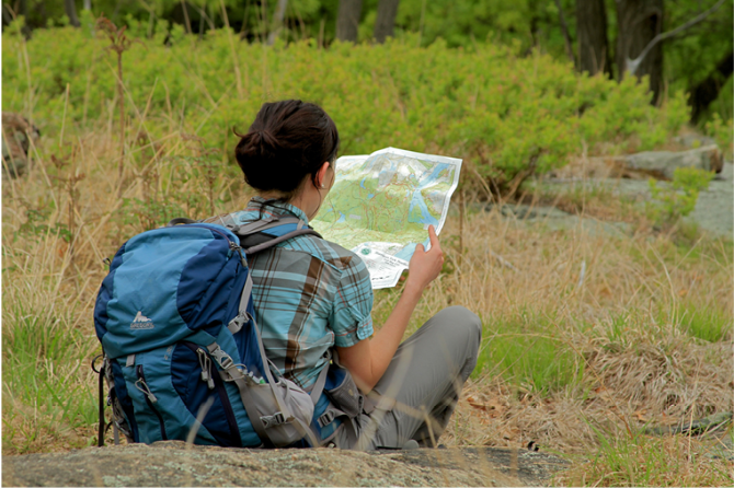
 Support the trails with a donation!
Trip Reports
rate experience August 04, 2018
What a beautiful little park!!!
I've lived in NJ for 40 years but never found this wonderful little park.
It was hot today - 86 degrees when I left the car - but the trail is very shady. It rained HEAVY yesterday and this morning, so the trails were very wet, but the streams and waterfalls were spectacular. I would definitely recommend doing this hike after there's been a lot of rain, with waterproof/Gortex shoes. I don't think it would be nearly as nice without the raging streams. However, crossing the Apshawa brook near the southern end of the Green Trail loop was a challenge and I was wading up to my knees in the stream.
August 03, 2017
Decent hike, views might be better during the wintertime
I did this hike today and finished it in about 2 and a half hours. I went somewhat slow and took a detour on the white and red outlook trails. The map provided by the Apshawa Preserve marks a viewpoint on the white trail, but during the summer it was mostly obscured by leaves. It was the same on the green trail, although one viewpoint was mostly unobstructed. The views weren't much to write home about, too. Wyanokie high point and the Silas County Park are within a short drive of this park, and they provide much more expansive views.
November 18, 2014
New Apshawa Trail Configuration
<p>Thank you for noting the map discrepancies on our Jersey Highlands map 125. The Apshawa trail system was reconfigured in 2013 with some new trail routes as well as changes to blaze colors, so our 1st edition map (published in 2011) does not show these trails entirely correctly. We will be sure to show the new configuration on the next 2nd edition revision of the maps.<br><br>A map available on the preserve's website shows the recent changes:<br>http://www.njconservation.org/apshawapreserve.htm<br><br>It is great to hear the trails were well-marked, although it is still recommended that one carry a map!<br><br>~Jeremy, TC Cartographer</p>