From the kiosk at the eastern end of the parking area, follow the yellow-blazed West Trapps Connector Trail which leads east, parallel to Route 44/55. In about 750 feet, a sign on the left marks the start of the red-blazed Shongum Path. Turn left and head downhill on the Shongum Path, the route of an old Lenape Indian trail. The trail crosses rock outcrops and descends through a dense hemlock...
Hike Description:
From the kiosk at the eastern end of the parking area, follow the yellow-blazed West Trapps Connector Trail which leads east, parallel to Route 44/55. In about 750 feet, a sign on the left marks the start of the red-blazed Shongum Path. Turn left and head downhill on the Shongum Path, the route of an old Lenape Indian trail. The trail crosses rock outcrops and descends through a dense hemlock forest.
After passing a junction with the yellow-blazed Enderly’s Path, which begins on the left, the trail crosses a stream on a wooden bridge. It follows a long stretch of narrow boardwalk across a wet area and continues along a gravel path bordered by rocks. After approaching the Coxing Kill and briefly paralleling an old stone wall, the Shongum Path descends steps to end at the Old Minnewaska Trail, a gravel road.
Turn left onto Old Minnewaska Trail (also the route of the Shawangunk Ridge Trail) and cross the bridge over the Coxing Kill. To the right is Split Rock, where the stream passes through a fascinating crevice in the bedrock. Continue ahead along the gravel road, passing ruins of the Enderly home on the right and their barn on the left, and cross paved Clove Road to reach the Coxing parking area. Bear left at the parking area towards a kiosk, where three light-blue blazes mark the start of the High Peters Kill Trail. You’ll be following the High Peters Kill Trail for the next three miles (this trail is also the route of the Shawangunk Ridge Trail, with its logo markers appearing at junctions and other locations along the way).
The High Peters Kill Trail follows a woods road, passing the Enderly Burial Ground on the right. It then crosses a wet area on a boardwalk and continues through a hemlock forest. After crossing a stream on a wooden bridge, the trail begins a gentle climb, paralleling the stream for a short distance. It then crosses the stream on rocks and bears right, away from the stream.
Soon, you’ll come to a junction with the yellow-blazed King’s Lane Trail, which continues straight ahead. You should turn left, following the blue-blazed trail, which levels off and follows an old stone wall through a former farm. Soon, another yellow-blazed trail begins on the right. After crossing another stream, the High Peters Kill Trail bears right and begins a steeper climb. Soon after recrossing the stream on rocks, the trail leaves the Mohonk Preserve and enters Minnewaska State Park Preserve..
The climbing now becomes very steep, with the trail routed over stone steps in places. For part of the way, the trail follows the Dugway, a 19th century woods road used to transport millstones quarried near here. After passing lichen-covered rock outcrops and an interesting “cave” formed by an overhanging rock, the grade moderates.
A short distance beyond the end of the steep climb, as the High Peters Kill Trail turns left, continue straight ahead on an unmarked trail. In about 150 feet, you’ll reach an expansive east-facing viewpoint over the Trapps ridge, with the Sky Top tower of the Mohonk Mountain House visible to the left. This is a good spot to take a break.
Return to the High Peters Kill Trail and turn right. The trail now follo ws a relatively level path through blueberries and mountain laurel, with some pitch pines. Just below the crest of the rise, the white-blazed Bull Wheel Trail, which leads to the Peters Kill parking area on Route 44/55, begins on the left. The High Peters Kill Trail now climbs to a pass between the low cliffs of Dickie Barre and begins a gradual descent.
After descending a short distance, you’ll reach an open area with pitch pines growing on exposed rock ledges. Here, the High Peters Kill Trail turns sharply right and begins a steady descent. You should continue straight ahead along the rocks to a dramatic viewpoint from the edge of the cliffs, with the Catskills visible in the distance to the right.
When you’ve spent some time enjoying this beautiful spot, return to the blazed trail and turn left, beginning a rather steep descent over exposed rock ledges. At the base of the descent, you’ll reach the picturesque Peters Kill. A yellow-blazed trail leads left to the Peters Kill parking area, but you should bear right to continue along the blue-blazed High Peters Kill Trail, which crosses the stream and a tributary on wooden truss bridges and then begins a steady climb through rhododendrons, mountain laurel and hemlocks.
After bearing left and heading southwest, parallel to the Peters Kill, you’ll reach a rock outcrop that affords a panoramic view over the valley of the Peters Kill and Dickie Barre. The trail follows the ridge high above the Peters Kill, climbing gradually, with many views from rock outcrops overlooking the valley below. Although the stream itself may not be visible, the roar of the water can be clearly heard.
After a while, Route 44/55 comes into view, and the trail begins to parallel the road. The ruins of an old stone building (built in 1922 as a powerhouse for the hotels at Lake Minnewaska) may be seen below. As the Peters Kill curves to the left and passes under Route 44/55, the High Peters Kill Trail continues through dense mountain laurel thickets. In another three-quarters of a mile (about 1.5 miles from the crossing of the Peters Kill), the High Peters Kill Trail ends at Route 44/55.
Cross the road and follow a blue-blazed path to a large parking area. Here you bear left and head east along a paved road parallel to the highway. At the entrance kiosk, bear right, following the sign “Trail to Awosting Falls.” When you reach the access road to Lake Minnewaska, turn right, cross a concrete bridge over the Peters Kill, then turn left onto the Awosting Falls Carriage Road. You’ll be following carriage roads for the next 3.5 miles – for nearly the entire return trip.
 The carriage road you are following was built in 1907 to link the Mohonk Mountain House with Minnewaska, and it is marked with red diamond blazes. The road descends on a broad curve to reach the base of the 65-foot-high Awosting Falls, which are particularly spectacular after heavy rains. Below the falls, the carriage road continues to parallel the scenic Peters Kill.
In about half a mile, the carriage road approaches Route 44/55. Here you should bear right at a fork to continue on the carriage road. In another half mile, bear left at the next fork. Soon, the white-blazed Awosting Falls Connector Trail begins on the left. Just beyond, the carriage road crosses paved Lyons Road and re-enters the Mohonk Preserve (the red blazes end here).
The carriage road, now known as Trapps Road, continues around a hairpin curve and, in another two-thirds of a mile, crosses the Coxing Kill on a wooden bridge. The carriage road continues to parallel Route 44/55, but for most of the way, the highway is located some distance from the carriage road and cannot be seen (although sounds of traffic can sometimes be heard). When you reach the Trapps Bridge over Route 44/55, cross the bridge, turn left, descend stone steps, and turn right on the yellow-blazed West Trapps Connector Trail that leads back to the parking area where the hike began.
Publication: Submitted by Daniel Chazin on 05/18/2004 updated/verified on 12/20/2017

This loop hike goes by the ruins of a former farm, climbs to the ridge of Dickie Barre, with expansive views, descends to cross the picturesque Peters Kill, follows a ridge high above the stream, and passes Awosting Falls.
41.73611, -74.200249
Ulster Co., NY
8 mi
5.5 hrs

Buy Map: *New* Shawangunk Trails Map
Avenza App Map: Shawangunk 105
Hike Checklist:
Whether you are going for a day hike or backpacking overnight, it is good practice to carry what we call The Hiking Essentials. These essentials will help you enjoy your outing more and will provide basic safety gear if needed. There may also be more essentials, depending on the season and your needs.
The Essentials
Hiking Shoes or Boots
Water - Two quarts per person is recommended in every season. Keep in mind that fluid loss is heightened in winter as well as summer. Don't put yourself in the position of having to end your hike early because you have run out of water.
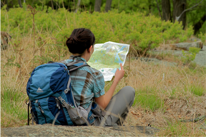
Map - Know where you are and where you are going. Many of our hiking areas feature interconnecting network of trails. Use a waterproof/tear-resistant Tyvek Trail Conference map if available or enclose your map in a Ziplock plastic bag. If you have a mobile device, download Avenza’s free PDF Maps app and grab some GPS-enhanced Trail Conference maps (a backup Tyvek or paper version of the map is good to have just in case your batteries die or you don't have service). Check out some map-reading basics here.
Food - Snacks/lunch will keep you going as you burn energy walking or climbing. Nuts, seeds, and chocolate are favorites on the trail.
Sunscreen and insect repellent
Rain Gear and Extra Clothing - Rain happens. So does cold. Be prepared for changing weather. Avoid cotton--it traps water against your skin and is slow to dry. If you are wearing wet cotton and must return to your starting point, you risk getting chills that may lead to a dangerous hypothermia. Choose synthetic shirts, sweaters and/or vests and dress in layers for easy on and off.
Compass - A simple compass is all you need to orient you and your map to magnetic north.
Light - A flashlight or small, lightweight headlamp will be welcome gear if you find yourself still on the trail when darkness falls. Check the batteries before you start out and have extras in your pack.
First Aid Kit - Keep it simple, compact, and weatherproof. Know how to use the basic components.
Firestarter and Matches - In an emergency, you may need to keep yourself or someone else warm until help arrives. A firestarter (this could be as simple as leftover birthday candles that are kept inside a waterproof container) and matches (again, make sure to keep them in a waterproof container) could save a life.
Knife or Multi-tool - You may need to cut a piece of moleskin to put over a blister, repair a piece of broken equipment, or solve some other unexpected problem.
Emergency Numbers - Know the emergency numbers for the area you're going to and realize that in many locations--especially mountainous ones, your phone will not get reception.
Common Sense - Pay attention to your environment, your energy, and the condition of your companions. Has the weather turned rainy? Is daylight fading? Did you drink all your water? Did your companion fail to bring rain gear? Are you getting tired? Keep in mind that until you turn around you are (typically) only half-way to completing your hike--you must still get back to where you started from! (Exceptions are loop hikes.)
Check the weather forecast before you head out. Know the rules and regulations of the area.
The Leave No Trace Seven Principles
Plan Ahead and Prepare
- Know the regulations and special concerns for the area you'll visit.
- Prepare for extreme weather, hazards, and emergencies.
- Schedule your trip to avoid times of high use.
- Visit in small groups when possible. Consider splitting larger groups into smaller groups.
- Repackage food to minimize waste.
- Use a map and compass to eliminate the use of marking paint, rock cairns or flagging.
Travel and Camp on Durable Surfaces
- Durable surfaces include established trails and campsites, rock, gravel, dry grasses or snow.
- Protect riparian areas by camping at least 200 feet from lakes and streams.
- Good campsites are found, not made. Altering a site is not necessary.
- In popular areas:
- Concentrate use on existing trails and campsites.
- Walk single file in the middle of the trail, even when wet or muddy.
- Keep campsites small. Focus activity in areas where vegetation is absent.
- In pristine areas:
- Disperse use to prevent the creation of campsites and trails.
- Avoid places where impacts are just beginning.
- Pack it in, pack it out. Inspect your campsite and rest areas for trash or spilled foods. Pack out all trash, leftover food and litter.
- Deposit solid human waste in catholes dug 6 to 8 inches deep, at least 200 feet from water, camp and trails. Cover and disguise the cathole when finished.
- Pack out toilet paper and hygiene products.
- To wash yourself or your dishes, carry water 200 feet away from streams or lakes and use small amounts of biodegradable soap. Scatter strained dishwater.
- Preserve the past: examine, but do not touch cultural or historic structures and artifacts.
- Leave rocks, plants and other natural objects as you find them.
- Avoid introducing or transporting non-native species.
- Do not build structures, furniture, or dig trenches.
- Campfires can cause lasting impacts to the backcountry. Use a lightweight stove for cooking and enjoy a candle lantern for light.
- Where fires are permitted, use established fire rings, fire pans, or mound fires.
- Keep fires small. Only use sticks from the ground that can be broken by hand.
- Burn all wood and coals to ash, put out campfires completely, then scatter cool ashes.
- Observe wildlife from a distance. Do not follow or approach them.
- Never feed animals. Feeding wildlife damages their health, alters natural behaviors, and exposes them to predators and other dangers.
- Protect wildlife and your food by storing rations and trash securely.
- Control pets at all times, or leave them at home.
- Avoid wildlife during sensitive times: mating, nesting, raising young, or winter.
Be Considerate of Other Visitors
- Respect other visitors and protect the quality of their experience.
- Be courteous. Yield to other users on the trail.
- Step to the downhill side of the trail when encountering pack stock.
- Take breaks and camp away from trails and other visitors.
- Let nature's sounds prevail. Avoid loud voices and noises.
The Trail Conference is a 2015 Leave No Trace partner.
(c) Leave No Trace Center for Outdoor Ethics: www.LNT.org.
Directions to Trailhead :
Take the New York State Thruway to Exit 18 (New Paltz). Beyond the toll booths, turn left onto Route 299 and continue west through the Village of New Paltz. After crossing the bridge over the Wallkill River at the west end of the village, continue ahead on Route 299 (do not turn right towards the Mohonk Mountain House). In another 5.5 miles (from the Wallkill River bridge), Route 299 ends at a T intersection with Route 44/55. Turn right here and follow Route 44/55 for half a mile to the Mohonk Preserve Visitor Center, on the right side of the road. Stop at the visitor center to purchase a pass, obtain a free map and view the interesting exhibits. Then continue ahead on Route 44/55. The road makes a very sharp hairpin turn and climbs to Trapps Bridge (a steel truss overpass). Continue for 0.3 mile past the Trapps Bridge, and turn right into the West Trapps Trailhead Parking Area.
TRAIN TRANSPORT :
Not availableBUS TRANSPORT :
Bus service to New Paltz from New York City, Nanuet, Newburgh and Kingston is available via Adirondack Trailways, www.trailwaysny.com (800) 776-7548. Limited weekday bus service to New Paltz from Kingston and Highland is available via Routes R and H of Ulster County Area Transit, ulstercountyny.gov/ucat/ulster-county-area-transit (888) 827-8228. Ulster County Area Transit also offers bus service from the Metro-North station in Poughkeepsie to New Paltz via their Ulster-Poughkeepsie Link. Taxi service from New Paltz to Mohonk is available from New Paltz Taxi, www.npztaxi.com (845) 255-1550.
 Support the trails with a donation!
Trip Reports
rate experience September 08, 2014
Another Peter's Kill Hike
<p>Fantastic pictures from one of our regular contributors, Daniella Wagstaff. Use this link: http://gonehikin.blogspot.com/2014/09/minnewaska-state-park-ny-peters-kill.html?utm_source=feedburner&utm_medium=email&utm_campaign=Feed%3A+GoneHikin+%28Gone+Hikin%27%29,</p>
April 07, 2014
GPS Coordinates
<p>Both map marker and GPS coordinates have been corrected to the West Trapps Parking Lot.</p>
April 06, 2014
Stunning views
<p>The gunks have stunning views, even in early spring when trees are yet to bud. Some time, I have to get there during leaf peeping season. </p>
<p> </p>
<p>The parking areas fill quickly, so it is a good thing to be prepared for if you don't arrive early. We typed in the GPS coordinates, and our GPS took us past the West Trapps parking lot, then the next right and ended closer to the Cox parking lot. This was actually fine, because the West Trapps parking lot was full when we arrived. The Cox parking lot was much smaller, but had several free parking spots. The hike description also has the hike passing the Cox parking lot, so this worked out perfectly.</p>
<p> </p>
<p>This hike does have some noise from the highway. The views make up for it though. The first half of the hike was moderate/strenuous with easy rock scrambling. The second half of the hike is on easy carriage roads. We did find the carriage roads by Awosting Falls still to be ice covered when we were there.</p>
<p> </p>
<p>Some photos: http://agiletrekker.blogspot.com/2014/04/dickie-barre-peters-kill-and-awosting.html</p>